


– Rochefort-Montagne.
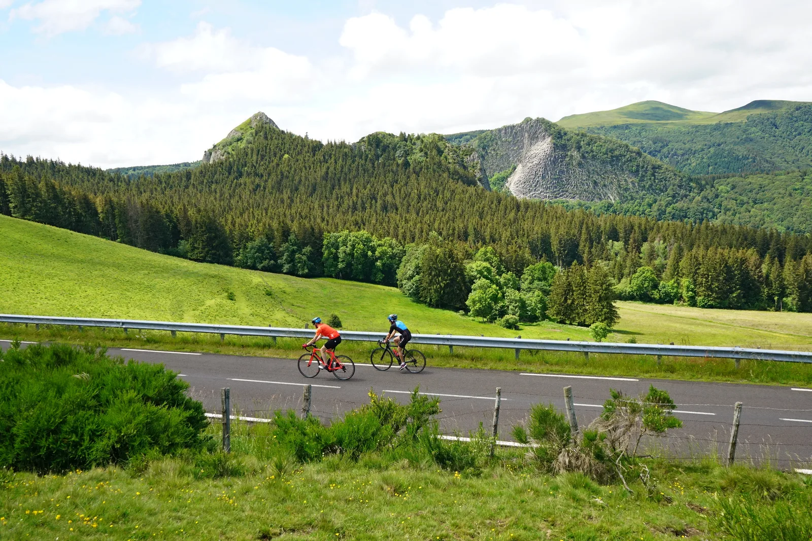
– The Tuilière and Sanadoire rocks.
– The Col du Guéry.
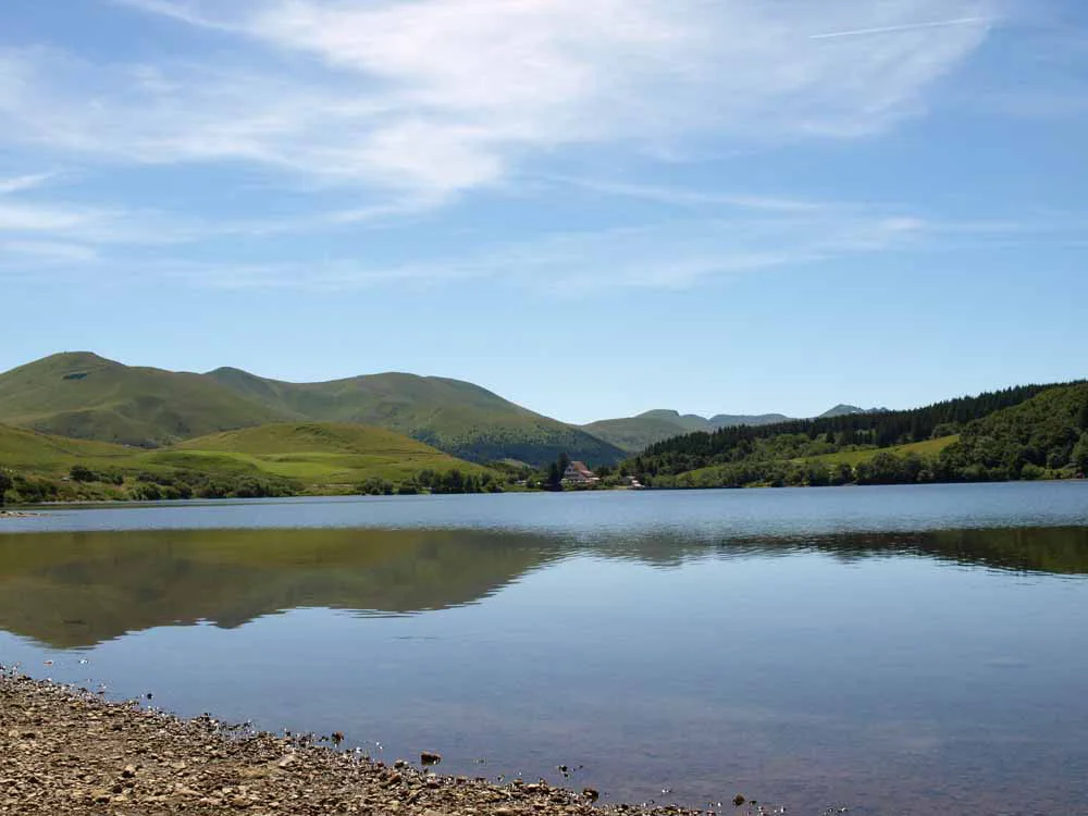
– Lake Guéry.
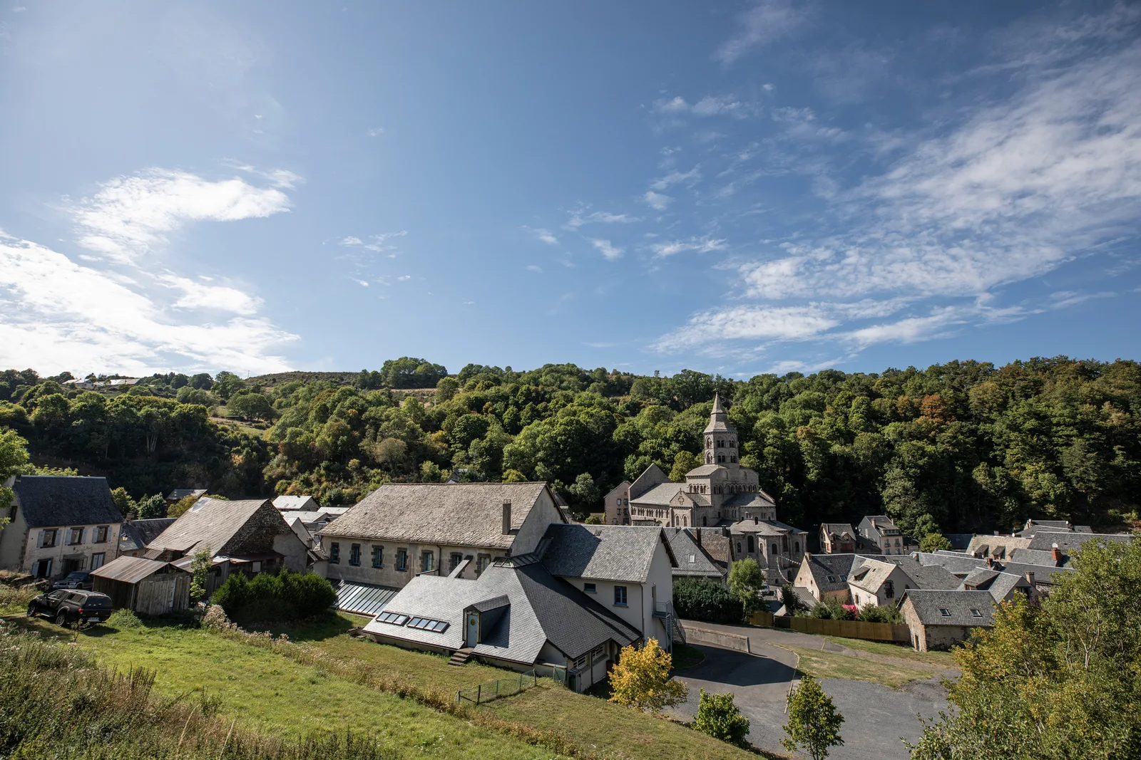
– Orcival and its Romanesque church.
– The Château de Cordes.
1/ You will leave Rochefort-Montagne to follow a winding road between the Tuilière and Sanadoire rocks, the remains of the cone of the same volcano.
2/ You continue towards the Col du Guéry (1264 m) and can stop at the edge of Lake Guéry to observe a most remarkable natural setting.
3/ You will then continue your route towards Orcival, a town on the Roman Art route with its Romanesque basilica, nestled in the Sioulot valley.
Near Orcival, take a short detour to visit the Château de Cordes with flowerbeds designed by Le Nôtre.
4/ The rest of the route will take you to Saint-Bonnet-près-Orcival, Saint-Pierre-Roche, Cisternes-la-Forêt and Heume-l'Église before reaching Rochefort-Montagne.
About 3 h 45 for an average speed of 20 km/h.
Route details
Description
You continue towards the Col du Guéry (1264 m) and can stop at the edge of the Lac du Guéry to observe one of the most remarkable natural surroundings.
You will then continue your route towards Orcival, a town on the Roman Art route with its Romanesque basilica, nestled in the Sioulot valley.
Near Orcival, take a short detour to visit the Château de Cordes with flowerbeds designed by Le Nôtre.
The rest of the route will take you to Saint-Bonnet-près-Orcival, Saint-Pierre-Roche, Cisternes-la-Forêt and Heume-l'Église before reaching Rochefort-Montagne.
About 3 h 45 for an average speed of 20 km/h.