


– Bagnols: Saint-Pierre church and conservatory garden.
– Small heritage: Calvary, cross, bread oven, fountain, dry stone walls.
– Wide panorama of the Sancy massif.
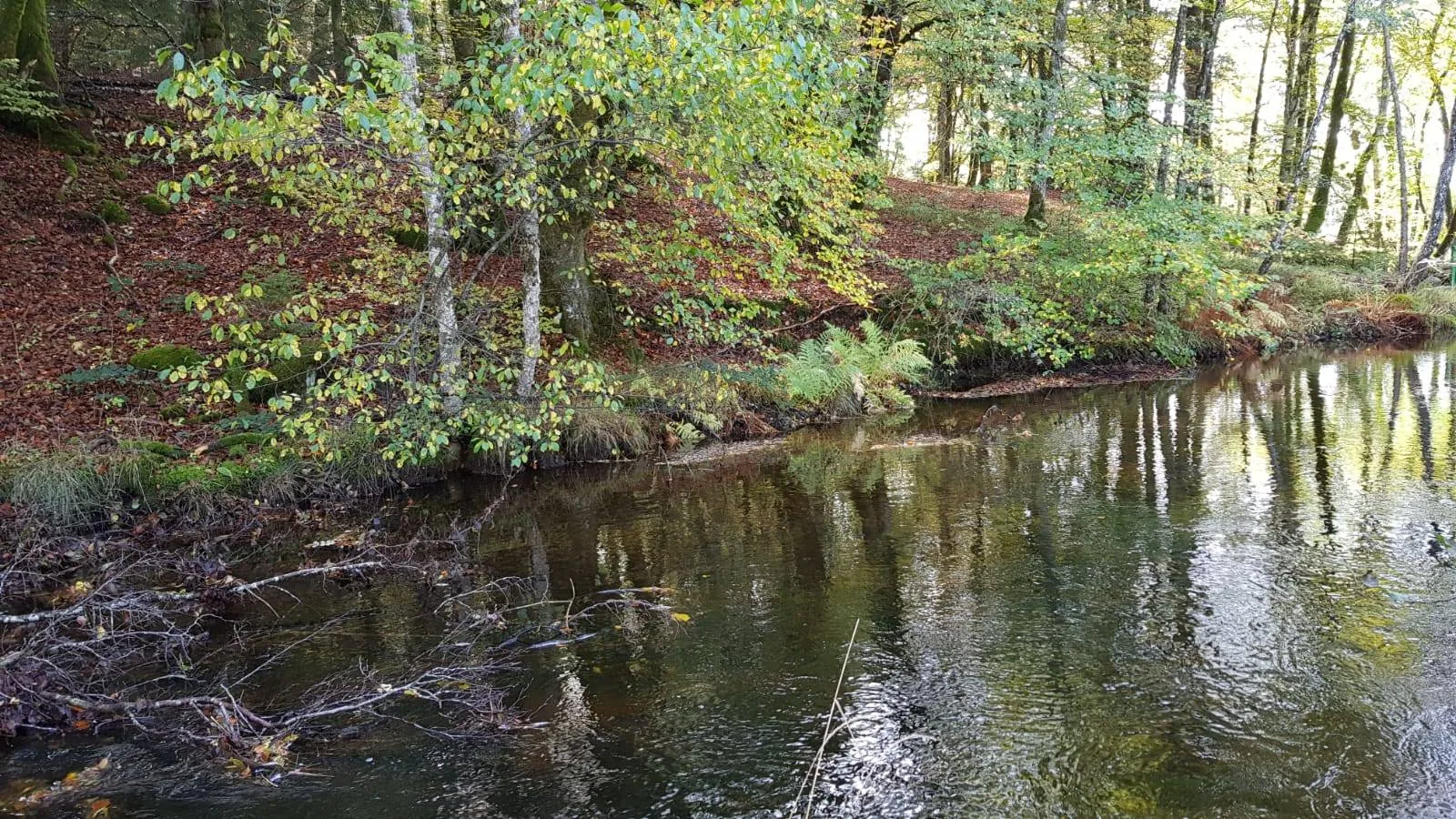
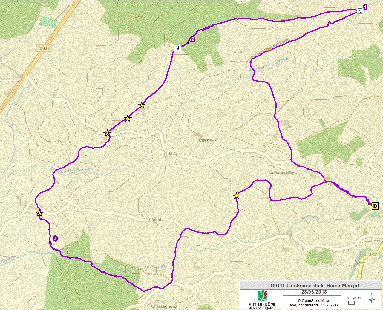
1/ From the starting panel, go under the arbor. At the end of the path, continue towards the pontoons. Cross them and turn left along the wall. Go up the stairs and follow the road on the left for 600 meters until you reach a small road going up to the right (direction La Fage). Take it and continue on a dirt road. At a first fork, turn right. At the next fork, go down left. Ford a stream and join Chemin de la Reine-Margot. Take the Roman road to the right until you reach a white cross and a water reservoir (wide panorama of the Sancy massif).
2/ Take a wide hairpin path on the left. Continue straight ahead until you reach a junction with, on the left, a narrow path between low walls.
3/ Follow this path until you reach an intersection with a wide path. Turn left (view of the Sancy) as far as Cornillat (at the entrance to Cornillat, old oak tree on the right then bread oven 50 meters on the left). Continue until the intersection with the D72 (70 meters on the right, Cornillat fountain). Cross the D72 to go down towards Espinasse. Cross a stream then go up left until you reach a road crossing Espinasse. Take it for 50 meters on the left. At the exit of the hamlet, turn right and walk alongside the bread oven. Continue to the last house, then go down to the right until the intersection with a narrower path.
4/ Take it on the left and enter the forest. Cross a small stream then follow the larger one. At a low wall, cross the stream and go up to the left. At the end of the woods, continue left until you reach the road. Take it on the left for 50 meters then go down the first path on the left. Continue immediately to the right. Cross a stream then reach a T intersection (wooden ordeal). Follow the road to the right. Take the first large dirt road on the left until you reach an intersection with a road (remarkable oak tree). Go right on the road crossing La Touraille. Shortly after a cottage, leave it to take a path on the right. At Calvary du Montel, take the road on the left. After a watering hole, follow a path on the left until you reach the D72. Take it on the right to reach the starting point by taking the outward route.
Route details
Description
1 – Take a wide hairpin path on the left. Continue straight ahead until you reach a junction with, on the left, a narrow path between low walls.
2 – Follow this path until you reach an intersection with a wide path. Turn left (view of the Sancy) as far as Cornillat (at the entrance to Cornillat, old oak tree on the right then bread oven 50 meters on the left). Continue until the intersection with the D72 (70 meters on the right, Cornillat fountain). Cross the D72 to go down towards Espinasse. Cross a stream then go up left until you reach a road crossing Espinasse. Take it for 50 meters on the left. At the exit of the hamlet, turn right and walk alongside the bread oven. Continue to the last house, then go down to the right until the intersection with a narrower path.
3 – Take it on the left and enter the forest. Cross a small stream then follow the larger one. At a low wall, cross the stream and go up to the left. At the end of the woods, continue left until you reach the road. Take it on the left for 50 meters then go down the first path on the left. Continue immediately to the right. Cross a stream then reach a T intersection (wooden ordeal). Follow the road to the right. Take the first large dirt road on the left until you reach an intersection with a road (remarkable oak tree). Go right on the road crossing La Touraille. Shortly after a cottage, leave it to take a path on the right. At Calvary du Montel, take the road on the left. After a watering hole, follow a path on the left until you reach the D72. Take it on the right to reach the starting point by taking the outward route.