


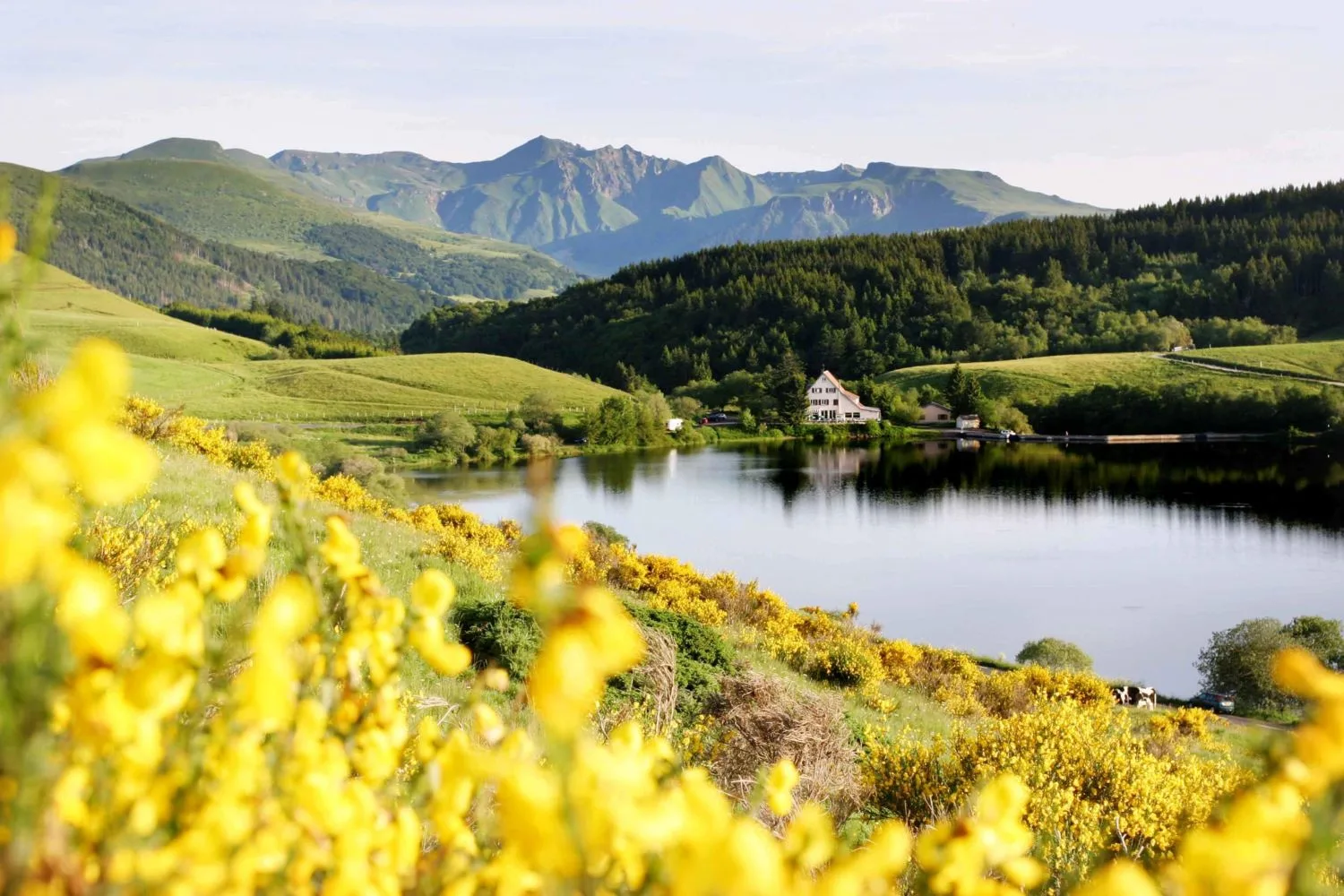
– Lac du Guéry.
– Waterfall and basalt organs.
– Landmark of the Four Lords.
– Banne d’Ordanche.
– Views of La Bourboule, Murat-le-Quaire, Le Mont-Dore and the Dordogne glacial valley.
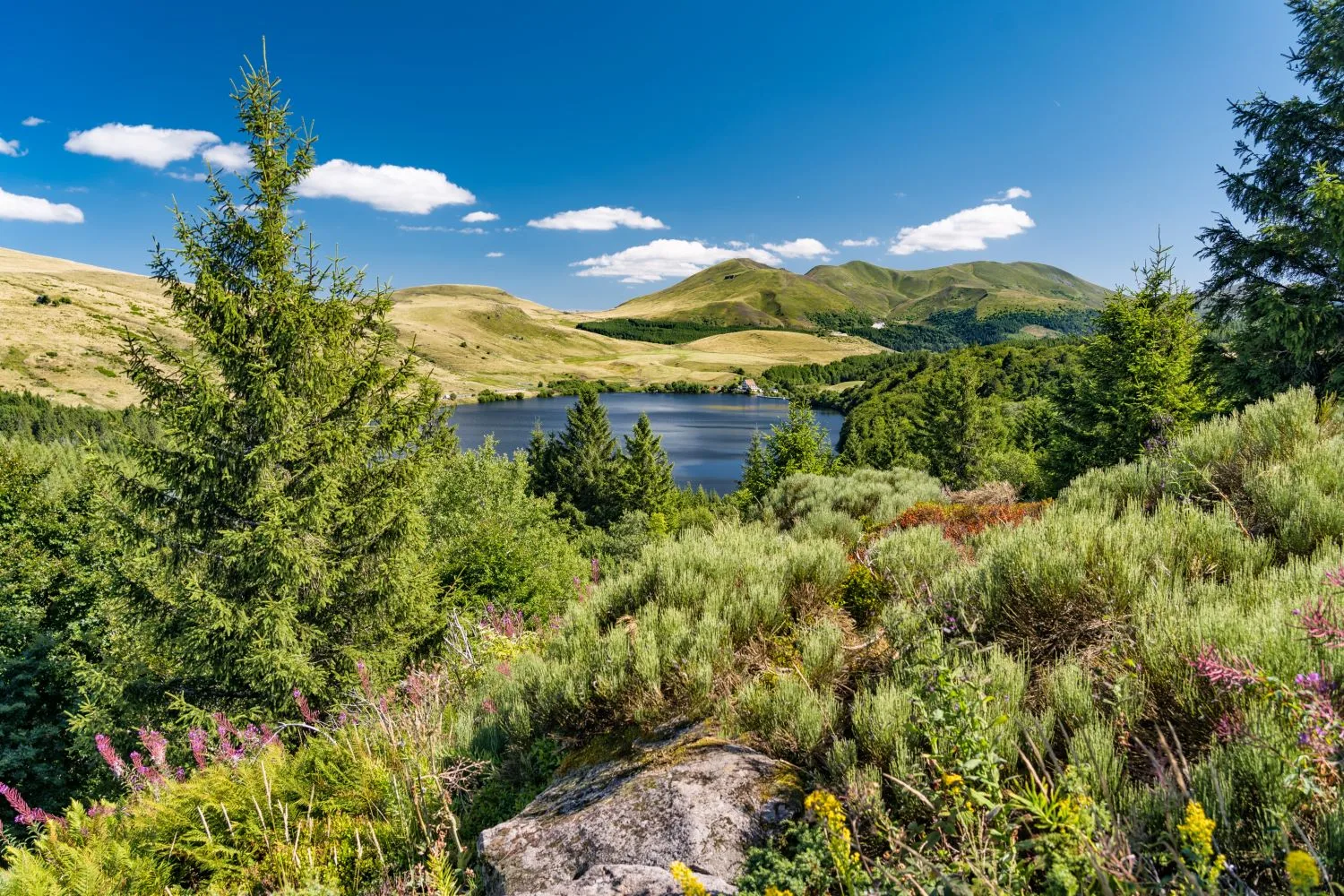
1/ From the start sign, go down the path leading to the lake then take the first path on the right. Take the pontoon, climb into the forest, turn left and continue (view of Lake Guéry) on the path set up along the edge of the lake until you reach a T-junction (information panel). Go up to the right in the beech forest to a viewpoint (waterfall and basalt organs) and continue climbing in the wood up to the barrier.
2/ Cross it and pass over the pontoons (view of the Col de la Croix Morand and the Puy de la Tache) located in a pasture. Walk alongside a wood and then enter it using the stepladder. Take a wide path on the right and at the first intersection, go left on a vehicle track and cross a first Canadian crossing. At a second Canadian crossing, 100 m before the ruined farm, go up to the right in the summer pastures, following the fence on the left to the Borne des Quatre Seigneurs (1450 m). Cross the chicanes and turn left onto a crest leading to the Col de Saint Laurent. Go straight, pass the barrier and at the terminal, go down left along the fence (Banne d'Ordanche and La Bourboule on the right) then go up to the ridge.
3/ Go up to the right, moving away from the fence, up to a small summit. Go back down via a chicane to a wide path below. Go up left for about 300m, turn right, pass a chicane and reach the path on the ridge of Puy Gros (view of the Sancy massif, Le Mont-Dore, La Bourboule, Murat-le-Quaire) and head towards the top of this puy after crossing a stepladder. At the top of Puy Gros, turn left, towards a large flat rock then take a path, heading north-east, barely visible at the beginning, which you go down to a crossroads (signposted marker).
4/ Go left for about 300 m, fence on the right, then go down to the right. Take the prepared passage and the stepladder then follow the track on the left through the summer pasture. Go through the fence and continue to the stepladder. Cross it and climb between the fences then go down to the edge of the woods. Ignore a path on the left and join a wide road. Take it on the left and continue until the lake. Turn left and in the woods go up a winding path overlooking the lake (view of Lake Guéry). Go down the prepared path and reach the starting point via the path along the lake.
Route details
Description
1 – Cross it and pass over the pontoons (view of the Col de la Croix Morand and the Puy de la Tache) located in a pasture. Walk alongside a wood and then enter it using the stepladder. Take a wide path on the right and at the first intersection, go left on a vehicle track and cross a first Canadian crossing. At a second Canadian crossing, 100 m before the ruined farm, go up to the right in the summer pastures, following the fence on the left to the Borne des Quatre Seigneurs (1450 m). Cross the chicanes and turn left onto a crest leading to the Col de Saint Laurent. Go straight, pass the barrier and at the terminal, go down left along the fence (Banne d'Ordanche and La Bourboule on the right) then go up to the ridge.
2 – Go up to the right, moving away from the fence, to a small summit. Go back down via a chicane to a wide path below. Go up left for about 300m, turn right, pass a chicane and reach the path on the ridge of Puy Gros (view of the Sancy massif, Le Mont-Dore, La Bourboule, Murat-le-Quaire) and head towards the top of this puy after crossing a stepladder. At the top of Puy Gros, turn left, towards a large flat rock then take a path, heading north-east, barely visible at the beginning, which you go down to a crossroads (signposted marker).
3 – Go left for about 300 m, fence on the right, then go down to the right. Take the prepared passage and the stepladder then follow the track on the left through the summer pasture. Go through the fence and continue to the stepladder. Cross it and climb between the fences then go down to the edge of the woods. Ignore a path on the left and join a wide road. Take it on the left and continue until the lake. Turn left and in the woods go up a winding path overlooking the lake (view of Lake Guéry). Go down the prepared path and reach the starting point via the path along the lake.