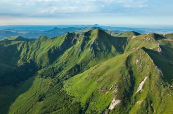
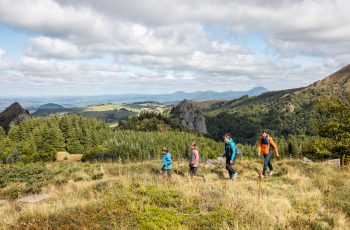
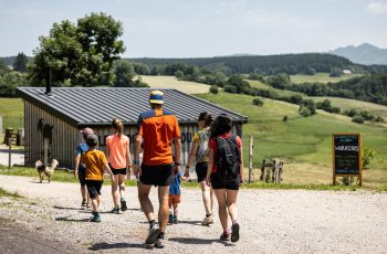
– View of the Sancy massif.
Topo / step by step1/ Go down the small road to the crossroads at the entrance to La Roche.
2/ Turn onto the road on the left. At the intersection, turn right onto a wide path until you find a double water trough. Opposite it, go down a path to the right. Pass near abandoned buildings. Cross a stepladder then, further on, a fence just before an intersection. Go left, cross the Le Burandou stream on a footbridge and continue opposite until you reach a crossroads. Turn left, skirt the Chomet farm and continue climbing on a wide path. At the crossroads, go left, pass a farm and join a road. Take it on the right. At the crossroads, go left until you reach an isolated house in La Plagne.
3/ Take the path on the left. Cross the Burandou again, continue opposite then go up to a road. Follow it to the right, cross a hamlet (Le Montel) and go up (viewpoint) to the entrance to the hamlet of Estaux.
4/ Go down the steep path on the left and continue it until you reach a road. Go left until you reach a hamlet. At the cross keep right for 80 m, leave the road and take a wide path opposite until you reach a crossroads (another yellow PR).
5/ Turn left onto a wide path, leave it after 400 m to go straight on a grassy path. It turns left (view of the Sancy and Cantal massifs) then immediately right until you reach a road. Take it on the left and cross Noilhat to reach the start.
Route details
Description
1 – Turn onto the road on the left. At the intersection, turn right onto a wide path until you find a double water trough. Opposite it, go down a path to the right. Pass near abandoned buildings. Cross a stepladder then, further on, a fence just before an intersection. Go left, cross the Le Burandou stream on a footbridge and continue opposite until you reach a crossroads. Turn left, skirt the Chomet farm and continue climbing on a wide path. At the crossroads, go left, pass a farm and join a road. Take it on the right. At the crossroads, go left until you reach an isolated house in La Plagne.
2 – Take the path on the left. Cross the Burandou again, continue opposite then go up to a road. Follow it to the right, cross a hamlet (Le Montel) and go up (viewpoint) to the entrance to the hamlet of Estaux.
3 – Go down the steep path on the left and continue it until you reach a road. Go left until you reach a hamlet. At the cross keep right for 80 m, leave the road and take a wide path opposite until you reach a crossroads (another yellow PR).
4 – Turn left onto a wide path, leave it after 400 m to go straight on a grassy path. It turns left (view of the Sancy and Cantal massifs) then immediately right until you reach a road. Take it on the left and cross Noilhat to reach the start.

