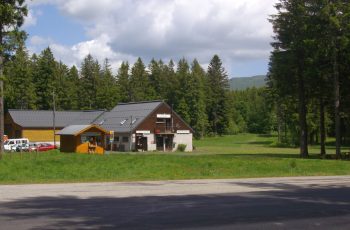
Parking at the start of the hike
2024-03-05
2024-03-16
Tips and Suggestions– View of the puys of Côme and Clersou.
– View of the Grand Suchet.
– Vulcania and Lemptégy volcano nearby.
1/ From the parking lot return to the road. Cross it and take the stone path opposite until you reach a curve where a path emerges.
2/ Stay on the main path. A hundred meters away (view of the Puy de Côme), take the path on the right under the trees. After walking through the beech forest, the path gradually rises to an intersection. Continue climbing to the right then descend slightly to a flat area (views of the Grand Suchet then the puy de Cliersou). At the T-junction, go up to the right until you reach a clearing blocked by a fence.
3/ Continue climbing to the left, following the fence. After the high point (view of the double cone of Puy de Côme), go down, always keeping the fence on the right hand side. Ignore a path on the left. At the level the path curves to the left away from the fence. Leave a closed path on the right. Go down the path, hollow and steep at the beginning, to a fork
4/ Choose the path on the right then join a wide path which you take to the right for 200 m. Leave it for a path on the right in the forest (hardly visible in advance). This path, sometimes up or down, often flat, winds through the forest, passing several ruined charcoal ovens. After crossing a pine forest, come to a crossroads (point 1). Take the stone path taken on the way in front and reach the car park after crossing the road.
Route details
Description
2/ Stay on the main path. A hundred meters away (view of the Puy de Côme), take the path on the right under the trees. After walking through the beech forest, the path gradually rises to an intersection. Continue climbing to the right then descend slightly to a flat area (views of the Grand Suchet then the puy de Cliersou). At the T-junction, go up to the right until you reach a clearing blocked by a fence.
3/ Continue climbing to the left, following the fence. After the high point (view of the double cone of Puy de Côme), go down, always keeping the fence on the right hand side. Ignore a path on the left. At the level the path curves to the left away from the fence. Leave a closed path on the right. Go down the path, hollow and steep at the beginning, to a fork
4/ Choose the path on the right then join a wide path which you take to the right for 200 m. Leave it for a path on the right in the forest (hardly visible in advance). This path, sometimes up or down, often flat, winds through the forest, passing several ruined charcoal ovens. After crossing a pine forest, come to a crossroads (point 1). Take the stone path taken on the way in front and reach the car park after crossing the road.


