


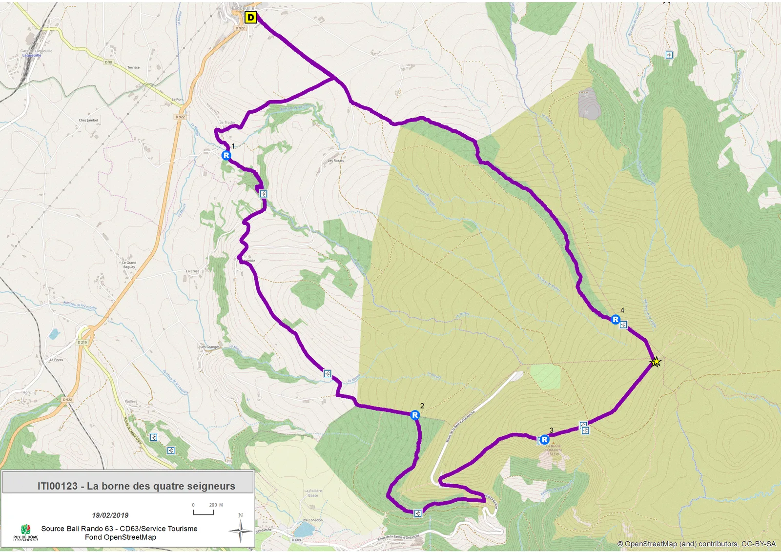
1/ Go up the street opposite the start sign then turn right on the road and right again 1 km further. In the village of Trador, at the cross, go down opposite towards the waterfall. At the first intersection, take the road on the left until you reach the car park.
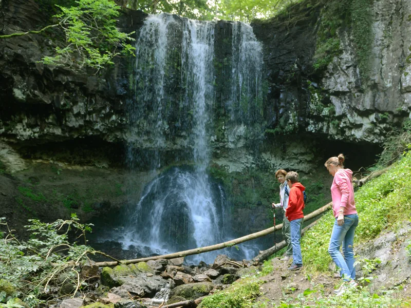
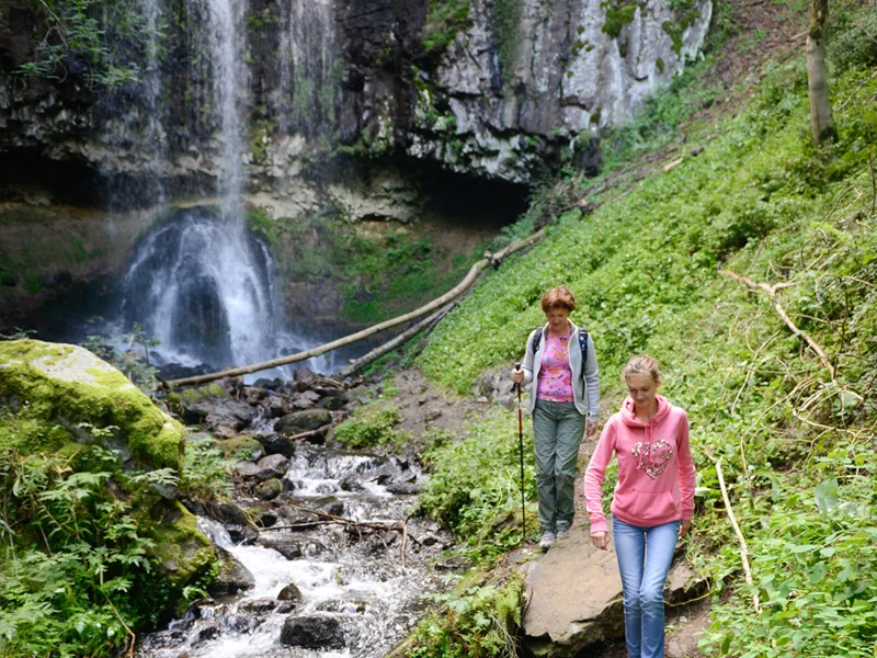
2/ Go left along the stream, cross a barrier, footbridges and advance to the foot of a staircase (10 min round trip to the waterfall). Climb the steps and continue climbing to the left. Continue straight ahead on a shaded sunken path. At the intersection, turn left onto
the road. In the hamlet of Estomble, take the second street on the left, it turns into a path. Stay right at the fork; At the T intersection, go left (view of the ruins of Cros de Sac on the left) and follow the woods until the second intersection.
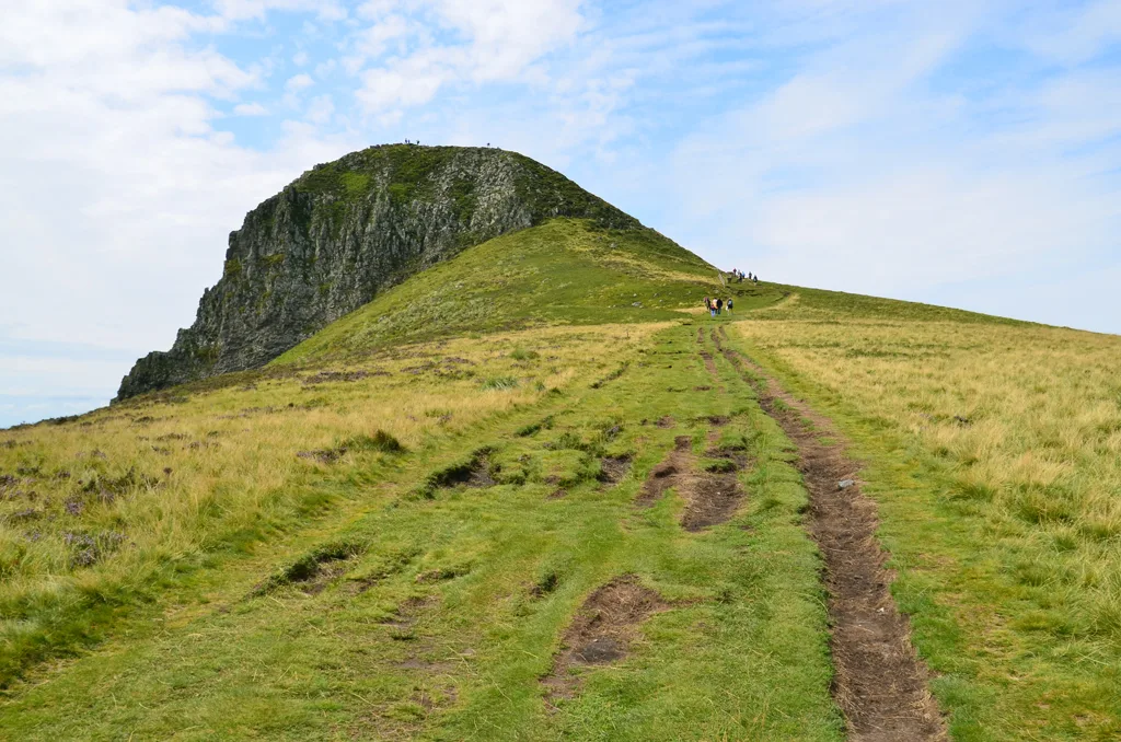
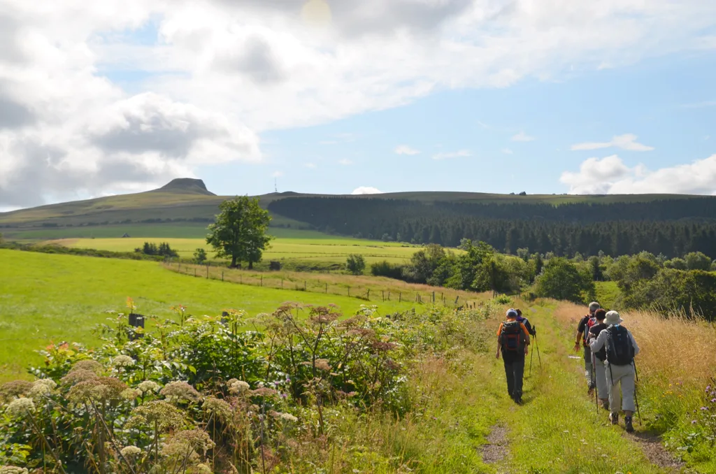
3/ Enter the wood on the right. Continue straight ahead, cut a very steep path and continue opposite along a balcony (Charlannes, Dordogne valley, Mont-Dore valley, Sancy massif, Puy Gros). About 100 m before reaching the road, at a post on the right, go up to the left on the moor to join the road. Follow it to the left along the slide. At the intersection, cross the road and go up to the car park. Follow a wide track on the right through the pastures towards the Banne d'Ordanche (Cantal mountains, Dordogne valley). Climb a few wooden steps to the staircase going down to the left. (Return: Ordanche banne – orientation table).
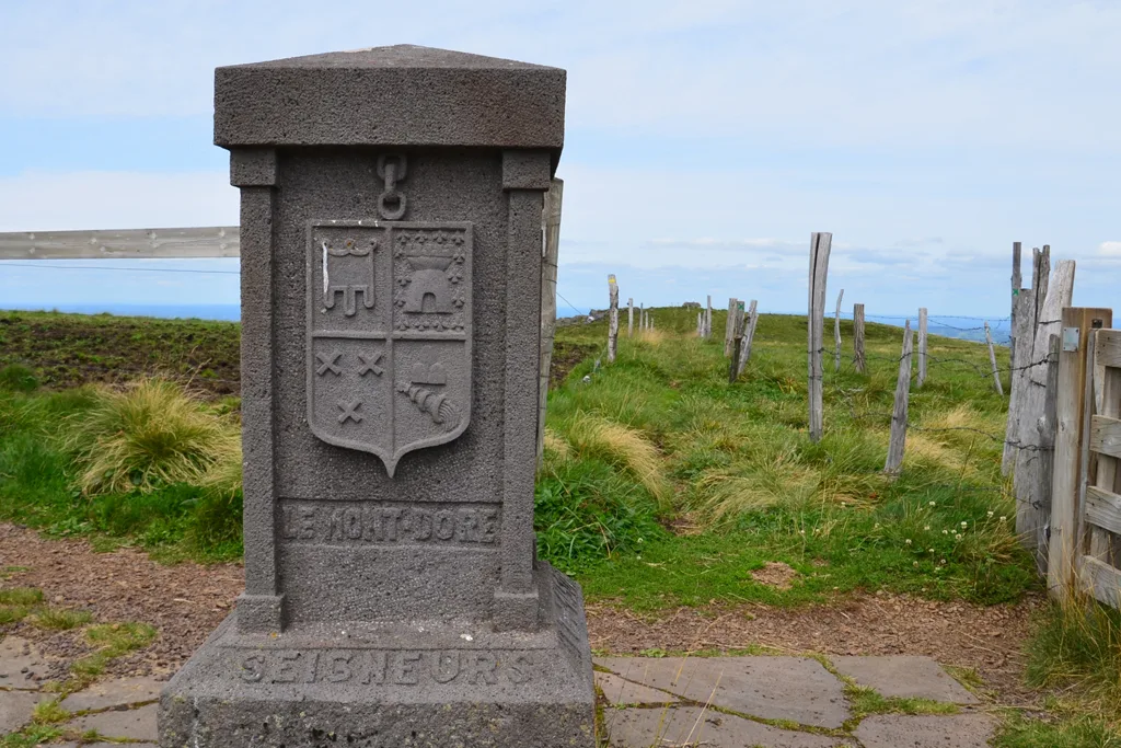
4/ Take it then follow the path to the intersection (Saint-Laurent pass). Go up opposite on a steep slope and continue straight through the pastures to reach the Quatre Seigneurs terminal. Go left between two fences, until they separate (view of the Puys chain).
5/ Walk along the one on the left, then enter the undergrowth. The path first follows the edge on the left then crosses the forest and finally runs along the right edge. At the end of the woods, go down to the road. Take it on the right to return to Laqueuille and reach the starting point.
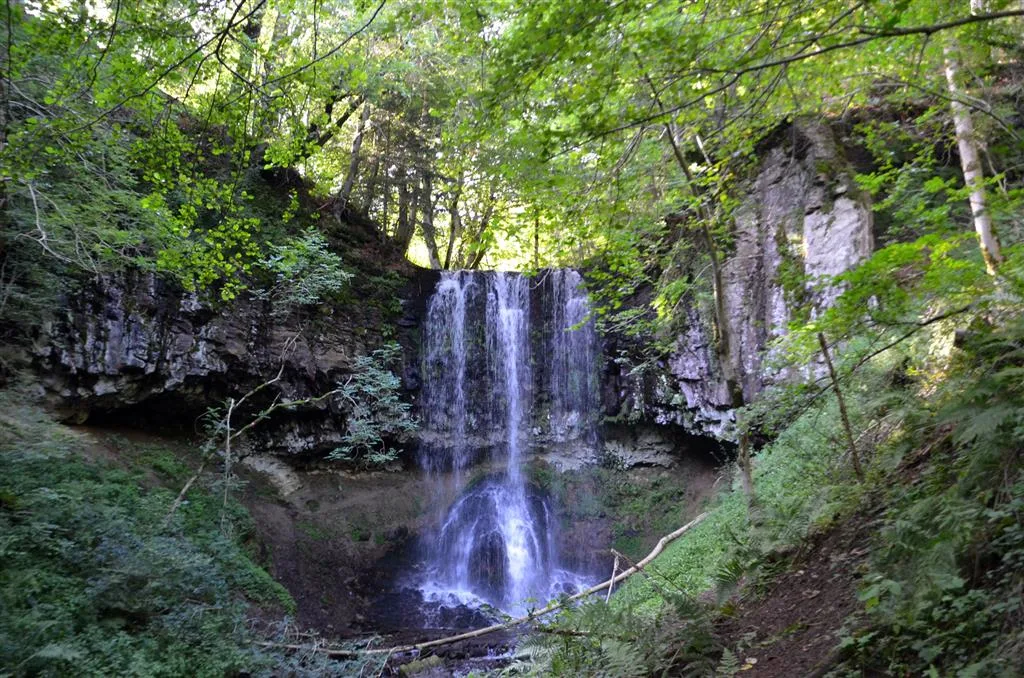
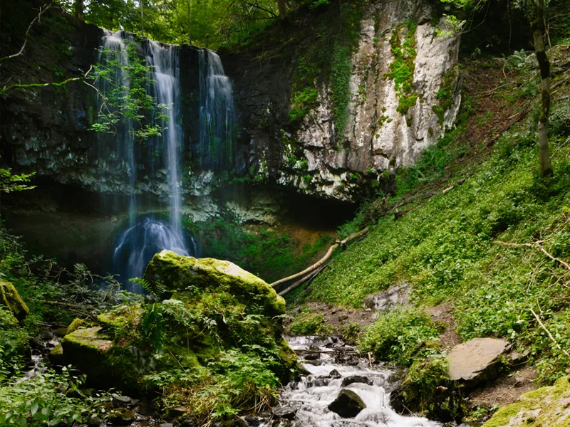
– The Trador waterfall (“volcanic organ”).
– The Verdeix stream.
– View of the ruins of Cros de Sac.
– View of Charlannes, the Dordogne and Mont-Dore valley, the Sancy massif and Puy Gros.
– The pastures towards the Banne d’Ordanche.
– View of the Cantal mountains.
– Orientation table at Banne d’Ordanche.
– The Saint-Laurent pass.
– The terminal of the Four Lords.
– View of the Chaîne des Puys.
– Nearby: Laqueuille spring water.
Route details
Description
1 – Go left along the stream, cross a barrier, footbridges and advance to the foot of a staircase (10 min round trip to the waterfall). Climb the steps and continue climbing to the left. Continue straight ahead on a shaded sunken path. At the intersection, turn left onto
the road. In the hamlet of Estomble, take the second street on the left, it turns into a path. Stay right at the fork; At the T intersection, go left (view of the ruins of Cros de Sac on the left) and follow the woods until the second intersection.
2 – Enter the wood on the right. Continue straight ahead, cut a very steep path and continue opposite along a balcony (Charlannes, Dordogne valley, Mont-Dore valley, Sancy massif, Puy Gros). About 100 m before reaching the road, at a post on the right, go up to the left on the moor to join the road. Follow it to the left along the slide. At the intersection, cross the road and go up to the car park. Follow a wide track on the right through the pastures towards the Banne d'Ordanche (Cantal mountains, Dordogne valley). Climb a few wooden steps to the staircase going down to the left. (Return: Ordanche banne – orientation table).
3 – Take it then follow the path to the crossroads (Saint-Laurent pass). Go up opposite on a steep slope and continue straight through the pastures to reach the Quatre Seigneurs terminal. Go left between two fences, until they separate (view of the Puys chain).
4 – Walk along the one on the left, then enter the undergrowth. The path first follows the edge on the left then crosses the forest and finally runs along the right edge. At the end of the woods, go down to the road. Take it on the right to return to Laqueuille and reach the starting point.