


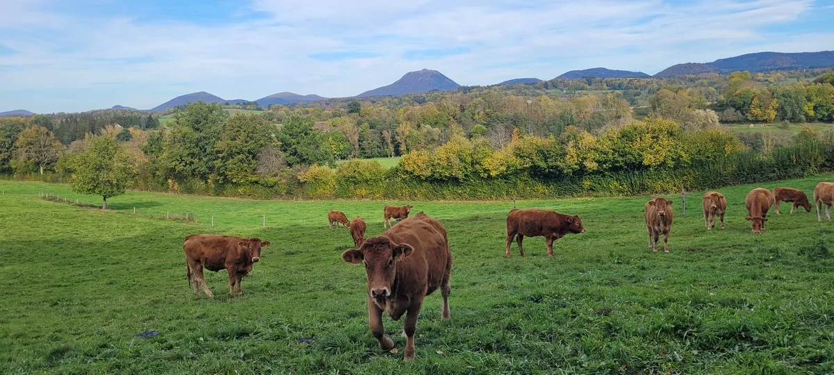
– View of the Puys chain.
– Volcanic organs, Olby flow.
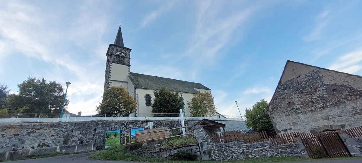
1/ From the start sign, below the church, go up the road; pass in front of the town hall and the school. Join the D 216, follow it to the right for 150 m then leave it for a path going up on the left. Continue to the entrance gate to the Château de Polagnat (PP1: XNUMXth-XNUMXth century castle).
2/ Go up the road on the right. After 200 m, go down left towards the village of Polagnat. After the first house, go up the road on the right. At the first sharp bend, leave it to take a wide path opposite for 500 m. At the fork, go up to the right and continue (PV1: view of the villages of Coheix, Olby and the Puy de Dôme) until you reach a crossroads in the forest.
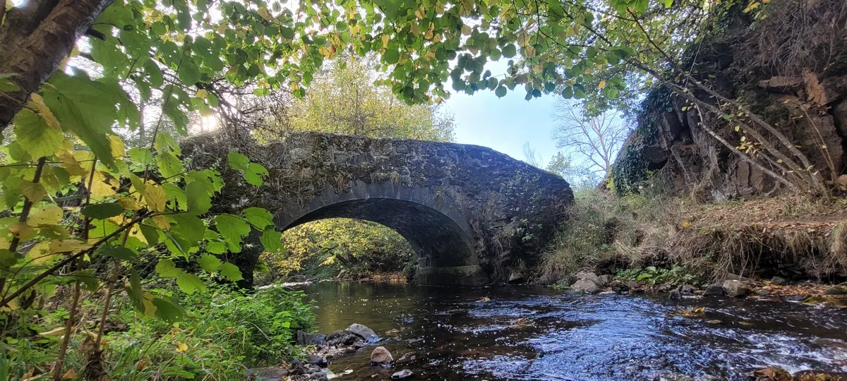
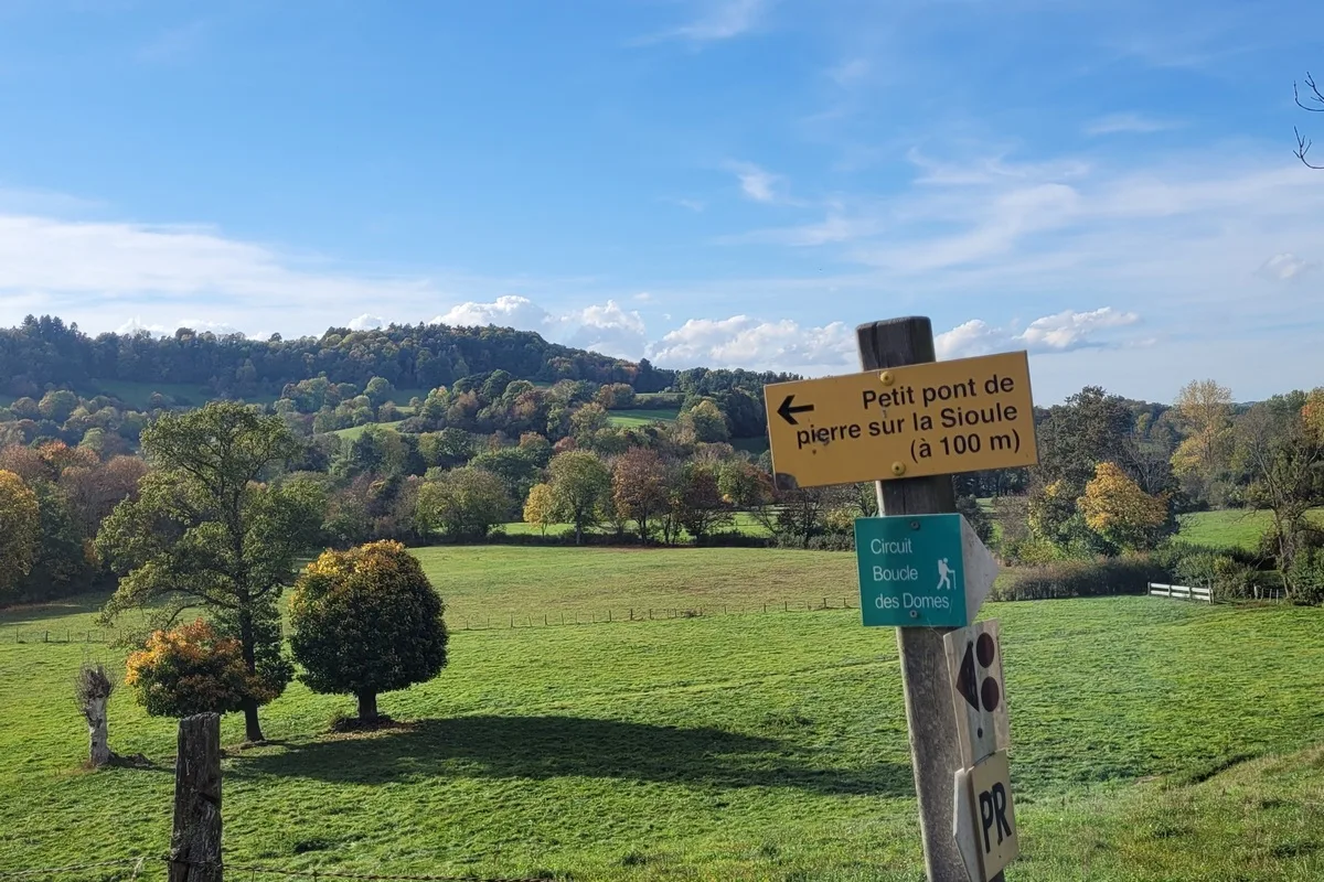
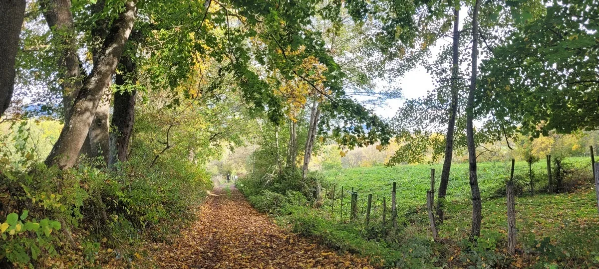
3/ Go down the forest path to the left and, after 50 m, turn right (GR) (PV2: view of the Puys chain). At the junction with a small road, follow it straight ahead. At the fork, go left, cross the bridge over the Sioule and continue on the road. Before arriving at Monteribeyre, take the first grassy path on the right below the village. After the first house, turn right into an undergrowth path (PV3: volcanic organs, Olby flow), up to the D 216, at the hamlet of Pont des Eaux.
4/ Cross the road and go opposite (direction Pradines). After the bridge, turn right into Impasse de la Sioule and, after the bridge, go up to the road. Follow it to the left for 100 m, then leave it at the bend to go up the path on the right. At 400 m, leave it to go left onto a grassy path in a pasture. At the intersection, go opposite, then, in the hamlet of Villejacques, take the second street on the left. Cross the D 216 and stay on the road until the entrance to the hamlet Moulin de Villejacques.
5/ Leave the road and take the path opposite. At the T-junction, follow the road on the left. After entering the campsite, go up to the right and reach the church.
Route details
Description
1 – Go up the road on the right. After 200 m, go down left towards the village of Polagnat. After the first house, go up the road on the right. At the first sharp bend, leave it to take a wide path opposite for 500 m. At the fork, go up to the right and continue (PV1: view of the villages of Coheix, Olby and the Puy de Dôme) until you reach a crossroads in the forest.
2 – Go down the forest path to the left and, after 50 m, turn right (GR) (PV2: view of the Puys chain). At the junction with a small road, follow it straight ahead. At the fork, go left, cross the bridge over the Sioule and continue on the road. Before arriving at Monteribeyre, take the first grassy path on the right below the village. After the first house, turn right into an undergrowth path (PV3: volcanic organs, Olby flow), up to the D 216, at the hamlet of Pont des Eaux.
3 – Cross the road and go opposite (direction Pradines). After the bridge, turn right into Impasse de la Sioule and, after the bridge, go up to the road. Follow it to the left for 100 m, then leave it at the bend to go up the path on the right. At 400 m, leave it to go left onto a grassy path in a pasture. At the intersection, go opposite, then, in the hamlet of Villejacques, take the second street on the left. Cross the D 216 and stay on the road until the entrance to the hamlet Moulin de Villejacques.
4 – Leave the road and take the path opposite. At the T-junction, follow the road on the left. After entering the campsite, go up to the right and reach the church.