


1/ From the departure sign, go down the road passing in front of the town hall to the cross erected in the middle of a fork.
2/ Take a damp path on the right which leads to a wide path. Turn left and walk as far as the D 579. Turn left and immediately take the path on the right to enter the hamlet of Bonnabaud. Go up to the left then go down to the right between the cross and the shoeing loom until you reach the road.
3/ Turn right under the water trough. At the exit of the village, at the cross (viewpoint over the Sioule valley), take the grassy path on the left below the castle wall. At the D 579a road, near the level crossing, turn right for 200 m and take the path opposite, with no exit, to the wastewater treatment plant. Go up the stairs full slope then the path to reach the plateau of Saint-Pierre-le-Chastel (viewpoint over the Sancy). Turn left to reach the cemetery and the church. Go around the multipurpose room and take the road on the left to go down to the town hall.
4/ Take the road on the left and at the exit of the village turn right, going backwards and below, the path to reach the Mazayes stream. Cross it and go up opposite, stay left and continue until a T-junction. Take the path on the right and continue to the Vergne stream. Turn right to cross it and climb to a cross. Go down the path on the left then at a stone cross turn right into Mazayes-Basses to reach the start.
– Site and church (11th century) of Saint-Pierre-le-Chastel.
– Small heritage sites (cross, fountain, well).
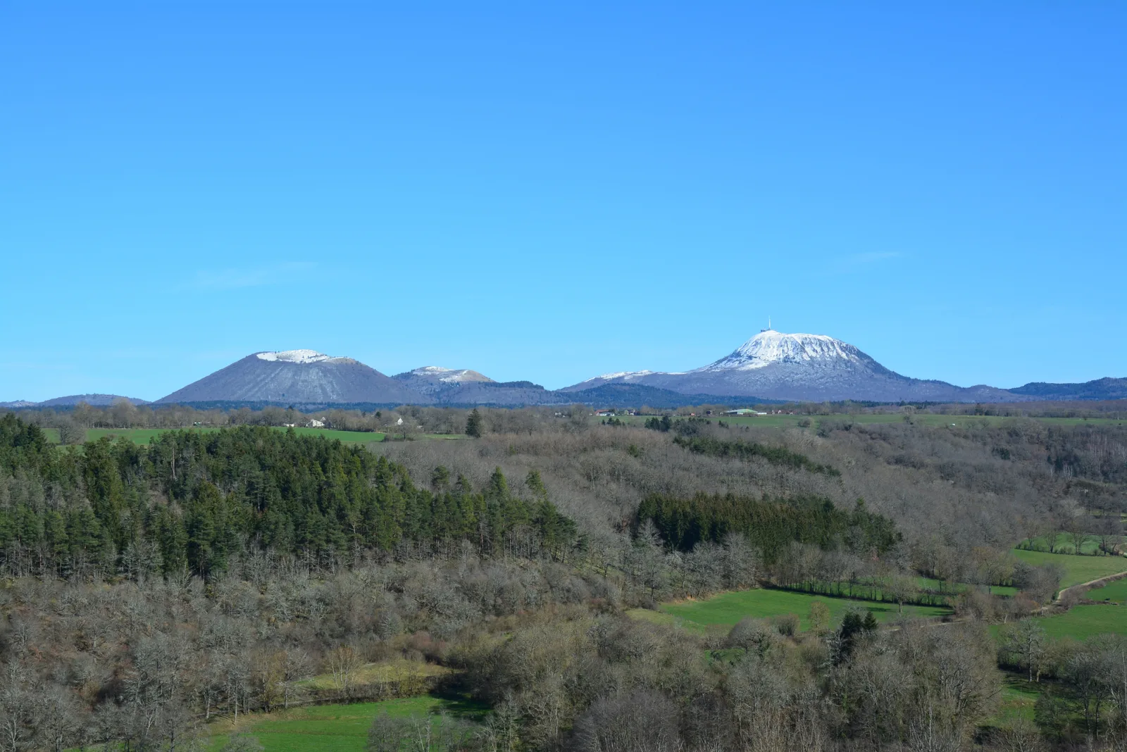
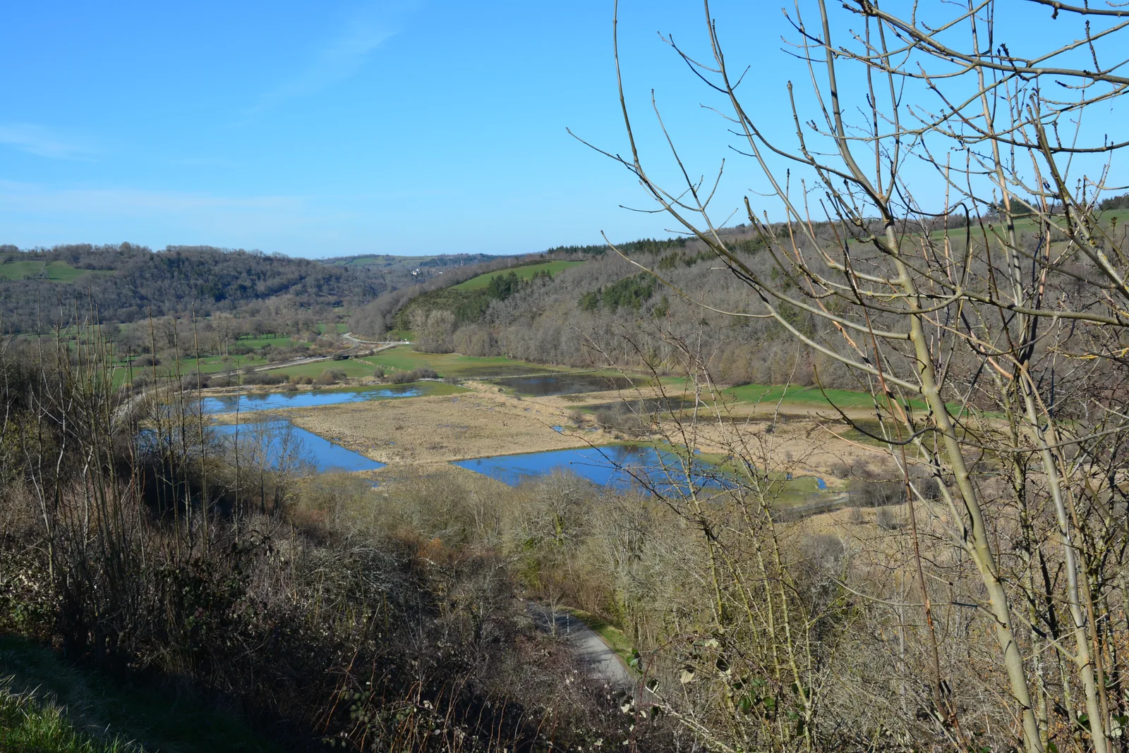
– View of the Sioule valley (Combrailles), the Sancy and the Chaîne des Puys – Limagne fault.
Route details
Description
1 – Take a damp path on the right which leads to a wide path. Turn left and walk as far as the D 579. Turn left and immediately take the path on the right to enter the hamlet of Bonnabaud. Go up to the left then go down to the right between the cross and the shoeing loom until you reach the road.
2 – Turn right under the water trough. At the exit of the village, at the cross (viewpoint over the Sioule valley), take the grassy path on the left below the castle wall. At the D 579a road, close to the level crossing, turn right for 200 m and take the path opposite, with no exit, to the wastewater treatment plant. Go up the stairs full slope then the path to reach the plateau of Saint-Pierre-le-Chastel (viewpoint over the Sancy). Turn left to reach the cemetery and the church. Go around the multipurpose room and take the road on the left to go down to the town hall.
3 – Take the road on the left and at the exit of the village take on the right, going backwards and below, the path to reach the Mazayes stream. Cross it and go up opposite, stay left and continue until a T-junction. Take the path on the right and continue to the Vergne stream. Turn right to cross it and climb to a cross. Go down the path on the left then at a stone cross turn right into Mazayes-Basses to reach the start.