


La Renaudie
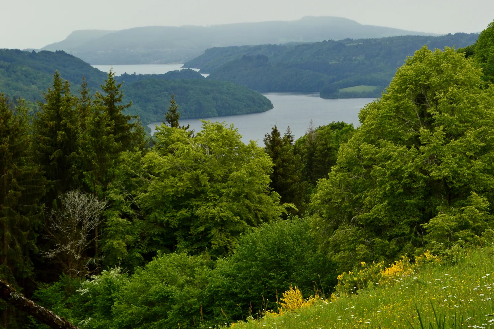
– Views of the reservoir of the Bort-les-Orgues dam.
– Views of the Dordogne and the old priory of Port-Dieu.
– Panoramic views of the two large volcanic massifs of Auvergne: the Dore mountains and the Cantal stratovolcano.
1/ From the departure sign, take the road towards La Renaudie for approximately 2 km (views to the left of the reservoir of the Bort-les-Orgues dam, then to the right of the Dordogne and the former priory of Port-Dieu ). At the first fork, turn right towards Banely. At the first houses, leave the road and take a path to the right then immediately left which leads into a meadow. Walk along the fence on the left then follow the path opposite until you reach the road.
2/ Go right to the hamlet of La Renaudie. At the cross, continue left. After the last house (view of the dam reservoir), go down the path through the undergrowth. Pass a first hairpin bend and continue for 100 m until the first path going down on the left.
3/ Take it and stay on this path, ignoring the paths on either side. After a stream, go up and continue the path on the hillside overlooking the Rigaud. Stop 50 m before the stream.
4/ Go up a barely visible track on the left, then continue on a path alongside the stream. After the footbridge, go up opposite and take a path on the left further along the Rigaud. After another footbridge, continue on the path opposite until you reach a fork.
5/ Stay to the right. Go up a winding path which becomes a path to reach the hamlet of Chastel. Follow the road on the left to reach the starting point.
Route details
Description
1 – Go right to the hamlet of La Renaudie. At the cross, continue left. After the last house (view of the dam reservoir), go down the path through the undergrowth. Pass a first hairpin bend and continue for 100 m until the first path going down on the left.
2 – Take it and stay on this path, ignoring the paths on either side. After a stream, go up and continue the path on the hillside overlooking the Rigaud. Stop 50 m before the stream.
3 – Go up a barely visible track on the left, then continue on a path alongside the stream. After the footbridge, go up opposite and take a path on the left further along the Rigaud. After another footbridge, continue on the path opposite until you reach a fork.
4 – Stay to the right. Go up a winding path which becomes a path to reach the hamlet of Chastel. Follow the road on the left to reach the starting point.