


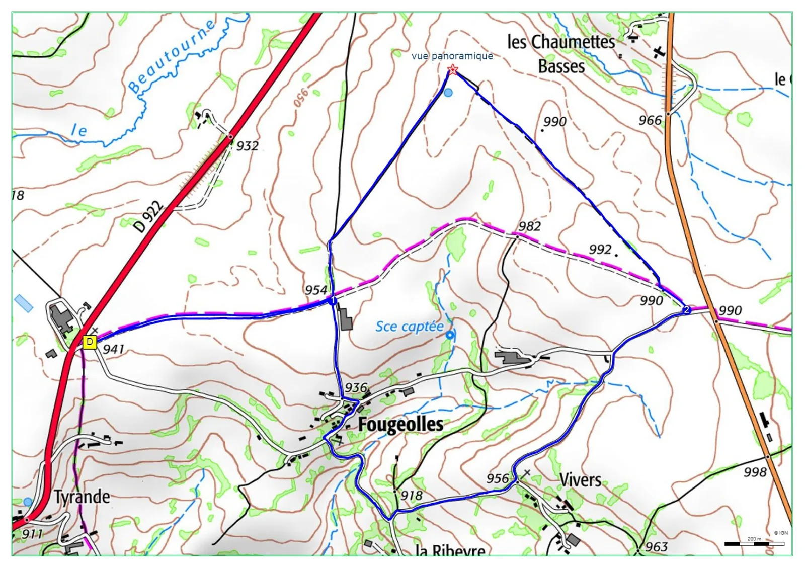
1/ From the start sign, travel 20m on the small road and take a wide path on the left. Continue for approximately 1 km until you reach an intersection.
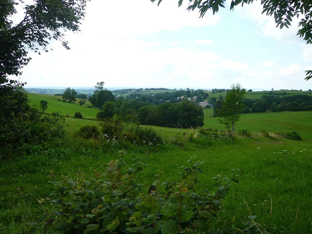
2/ Turn left. Further on, ignore a path on the left, and 150 m after a water tower (panoramic view of Sancy, Cantal, Corrèze, Plateau de Mille Vaches), turn right. Leave a path on the right and continue straight on until you reach an intersection with a small road.
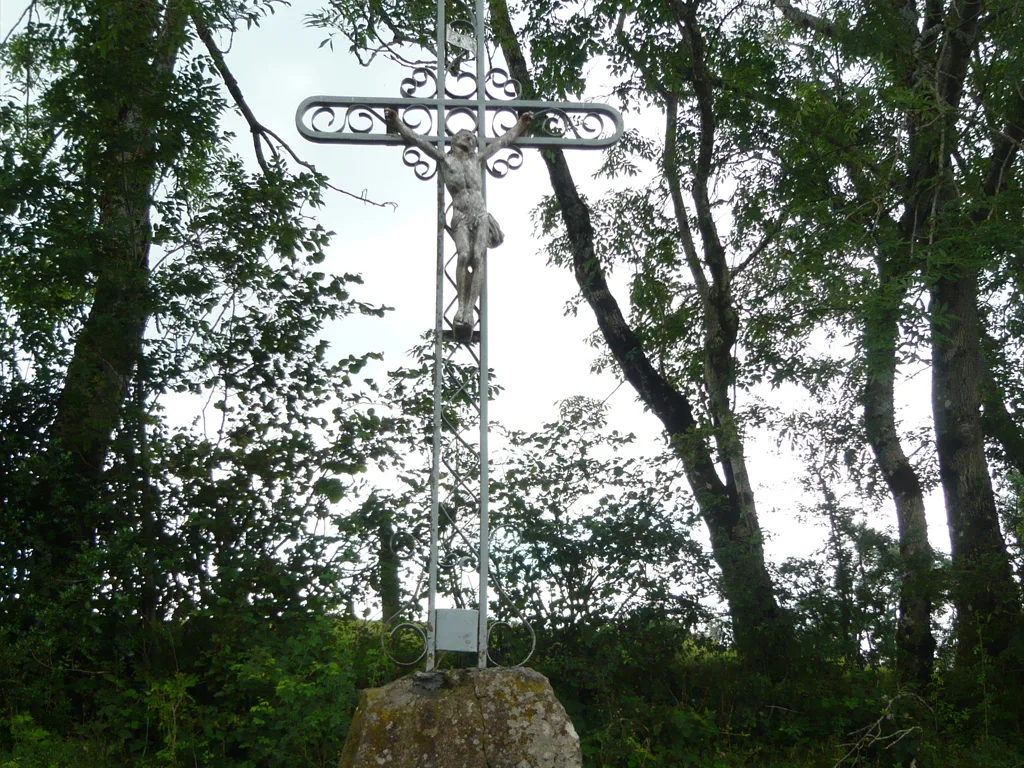
3/ Take it from the right. At the crossroads (cross on the left), go down to the right, leave a first path on the right, continue downhill to a transformer at a place called La Ribeyre. Go right towards Fougeolles. Go up to a T-intersection (cross), turn right, then left at the next intersection. Continue straight ahead to reach point 1, and go left to reach the starting sign.
– Panoramic view of Sancy, Cantal, Corrèze and the Mille Vaches plateau.
– Small heritage: cross.
Route details
Description
1 – Turn left. Further on, ignore a path on the left, and 150 m after a water tower (panoramic view of Sancy, Cantal, Corrèze, Plateau de Mille Vaches), turn right. Leave a path on the right and continue straight on until you reach an intersection with a small road.
2 – Take it from the right. At the crossroads (cross on the left), go down to the right, leave a first path on the right, continue downhill to a transformer at a place called La Ribeyre. Go right towards Fougeolles. Go up to a T-intersection (cross), turn right, then left at the next intersection. Continue straight ahead to reach point 1, and go left to reach the starting sign.