


Bois de Bourelles
1/ From the church square, go up the street towards the 4 roads, alongside the “l'Ajasserie” hotel. At the stop sign, cross the D27 and go up the path opposite to the Notre-Dame chapel.
2/ Take the path on the left under the chapel to the hamlet “La Croix” which you cross. At the exit, go right onto a wide path followed by the GR 30. Continue straight ahead until you reach a crow's foot.
3/ Go up to the right towards a wood. Along it (view of the Puys chain on the left). Go down this wide path at the edge of the woods until you reach a T-junction.
4/ Go up to the right (we leave the GR), and again to the right at the next crow's foot. The path goes around the Puy de Gravenoire and arrives on the plateau perpendicular to a wide path.
5/ Take it to the left and at the first crossroads take another wide path to the left in the forest. Continue straight ahead until the edge of the woods (view of the Puys chain). Enter the forest again by following the path on the right. At the T-junction, at the end of the woods (view of the Tuilière and Sanadoire rocks on the left), go down the wide path to the left until you reach the road.
6/ Take this to the right for 100 m and turn right again onto a path below. Go down towards a farm and follow a tarmac path then a road on the right until you reach the D27. Cross it to reach the starting point.
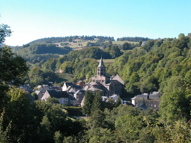
– Orcival and its basilica.
– Near Orcival: Cordès castle.
Route details
Description
1 – Take the path on the left under the chapel to the hamlet “La Croix” which you cross. At the exit, go right onto a wide path followed by the GR 30. Continue straight ahead until you reach a crow's foot.
2 – Go up to the right towards a wood. Along it (view of the Puys chain on the left). Go down this wide path at the edge of the woods until you reach a T-junction.
3 – Go up to the right (we leave the GR), and again to the right at the next crow’s foot. The path goes around the Puy de Gravenoire and arrives on the plateau perpendicular to a wide path.
4 – Take it to the left and at the first crossroads take another wide path to the left in the forest. Continue straight ahead until the edge of the woods (view of the Puys chain). Enter the forest again by following the path on the right. At the T-junction, at the end of the woods (view of the Tuilière and Sanadoire rocks on the left), go down the wide path to the left until you reach the road.
5 – Take this to the right for 100 m and turn right again onto a path below. Go down towards a farm and follow a tarmac path then a road on the right until you reach the D27. Cross it to reach the starting point.